Katla volcano and the Mýrdalsjökull glacier
You book for the ice cave, but the volcano underneath explains almost everything you see on the way. Katla lies under the Mýrdalsjökull ice cap east of Vík. Its floods built the black plain the Super Jeeps cross, and the dark bands in the cave walls are its ash. This page covers the geology and the history in plain words, with the numbers kept approximate, as the sources give them.
A volcano under an ice cap
Katla is one of Iceland's most active volcanoes, and you never actually see it. Its cover is Mýrdalsjökull, the fourth largest ice cap in Iceland, spread over close to 600 km² (230 sq miles) inland from Vík. The summit of the volcano is a caldera, a wide sunken crater roughly 10 by 14 km (about 6 by 9 miles) across, buried under ice up to about 700 m (2,300 ft) thick. From the black sands on the drive to the cave you look up at a smooth white dome, with nothing on its surface to show what sits beneath.
Eruptions and the floods they send
Big eruptions of Katla have come on average every few decades, roughly twice a century. When one starts under the ice, the heat melts the glacier from below. The meltwater then bursts out as a jökulhlaup, the Icelandic word for a glacial flood. The last eruption to break through the ice came in 1918. Its flood poured across Mýrdalssandur and pushed the coastline out into the sea.
Smaller floods have come since. In 2011 one washed away the Ring Road bridge over the Múlakvísl river east of Vík, cutting the main road along the south coast for a time. Nobody on a tour needs to fear the volcano, but the history explains why the glacier is never treated casually, a point our guide to safety on the ice picks up in detail.
The black sands you cross
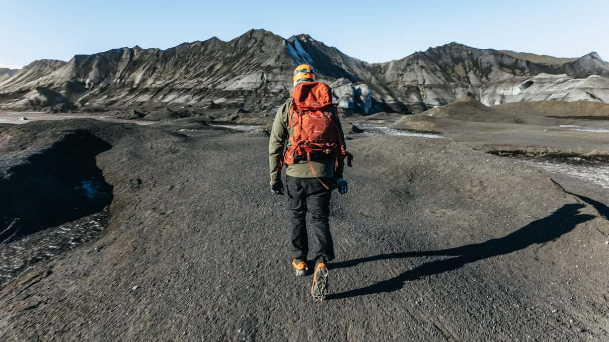
Mýrdalssandur, the wide black plain east of Vík, is Katla's work, laid down by its floods and crossed today by Route 1. The Super Jeeps leave the tarmac here and spend 30–60 minutes on sand and rough track, depending on the operator. Look for Hafursey, the mountain that rises out of the sands, which Troll.is and Gravel Travel both mention on their routes. Toward the sea stands Hjörleifshöfði, a lone hill on the flat ground that Gravel Travel passes on the way back.
Seen from a jeep window the plain looks empty and harmless. Its size is the clearest sign of how much water the volcano has sent down in the past, and it is one reason the cave is visited only with a guide. If you are coming by car, the meeting-point guide lists where each operator gathers its group in Vík.
Kötlujökull, where the cave forms
Kötlujökull is the outlet glacier that spills off the eastern side of Mýrdalsjökull toward the sands. The name means Katla's glacier, and the cave you visit is sometimes called the Kötlujökull ice cave. Glacier caves like this one form where meltwater runs under and through the ice, and they change with every season. Because the glacier keeps moving and melting, the cave you walk into is never quite the one in last year's photos, and operators move to a new one when the old one turns unsafe.
The black and gray stripes in the walls are tephra, ash and grit thrown out by past eruptions that settled on the glacier and were buried in the ice. That banding is what sets the Katla cave apart from the clear blue caves of Vatnajökull; Katla or Vatnajökull compares the two, and our photography guide explains how to show the stripes in dim light.
Eyjafjallajökull next door
West of Mýrdalsjökull sits a smaller ice cap over Eyjafjallajökull, the volcano whose 2010 eruption grounded flights across Europe. You pass below it on Route 1 between Reykjavík and Vík, close to Skógafoss. The names are easy to confuse, but the cave tours go to Katla's glacier, not to Eyjafjallajökull.
A guide with the Katla stories
Arctic Adventures crosses Mýrdalssandur by Super Jeep to a beginner-friendly glacier walk in groups of up to 14, and reviewers mention guides sharing folklore about Katla on the way, from ~$188. Cancel free up to a day ahead.
Who keeps watch
The Icelandic Met Office watches Katla with seismometers and GPS, which pick up earthquakes and movement of the ground. If the volcano shows unrest, the tours stop until it settles, so a cancelled day is the system working rather than bad luck. Before you travel, vedur.is carries the Met Office's news and safetravel.is posts alerts for visitors. Every main tour cancels free until 24 hours ahead, which matters on a coast where storms close roads too; our page on timing your visit deals with the weather side.
The whole area belongs to the Katla Geopark, a UNESCO Global Geopark that takes in the volcano and the sands around it. We are not connected to the Geopark or to any operator; we only compare the tours.
The housekeeper on the glacier
A folk tale says the volcano takes its name from Katla, a hot-tempered housekeeper who fled onto the glacier, and the mountain has carried her name ever since. Versions differ in the details, and Arctic Adventures reviewers mention guides telling Katla folklore on the drive out. Ask yours, since the stories make the sands feel less empty.
More time near the volcano
To see more of the glacier than a 3-hour trip allows, Troll.is runs an extended 4-hour version, from ~$292. It takes up to 14 people from Víkurbraut 26 on a longer hike around the glacier, and the listing promises glacier canyons and hidden waterfalls. The catch is the short record, with very few reviews so far, and one reviewer saw nothing from the jeep in fog.
Without a car, the Troll.is day tour from Reykjavík, from ~$285, brings you to the same glacier by minibus with up to 18 people, stopping at two waterfalls on the way out and at Reynisfjara beach afterwards. The catch is a long day of about 12 hours, and hiking boots are compulsory, though they can be rented on site. The Reykjavík guide weighs it against driving yourself, and what a Katla ice cave tour costs lines up every price.